What do the oceans tell us about drought? |
| By Amber Friedrichsen, Managing Editor |
|
|
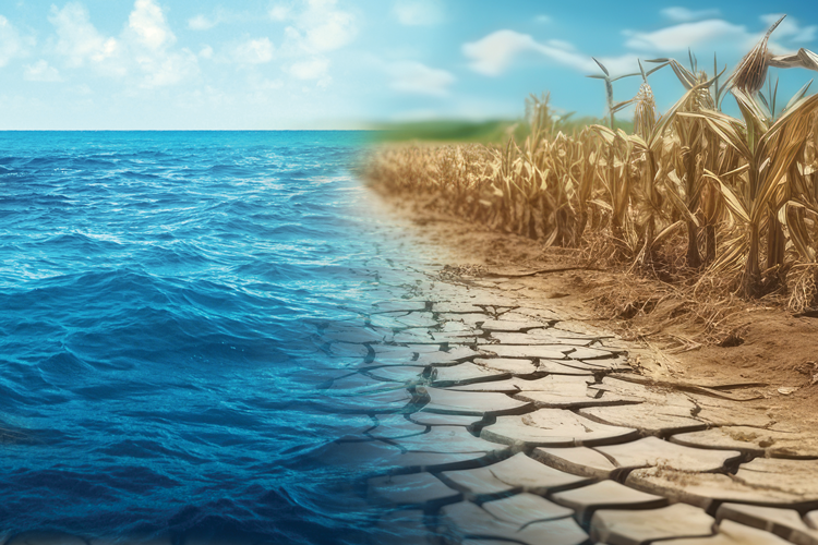 In 1998, the average price of gas was $1.06 a gallon. That year, the Denver Broncos won their first Super Bowl, John Glenn took off on the space shuttle Discovery mission, and the “Titanic” was awarded Best Picture at the Oscars. According to Matt Makens, 1998 is also when farmers started a decades-long wrestling match with high-frequency drought. Makens is a meteorologist and atmospheric scientist with Makens Weather LLC based in Colorado. Every year during the CattleFax Outlook Seminar at the Cattle Industry Convention, he shares his predictions for the El Niño and La Niña weather patterns that could take shape throughout the spring, summer, and fall. To do this, he uses historic data and meteorological modeling to create temperature and moisture outlooks based on sea surface temperatures of the El Niño Southern Oscillation (ENSO) region of the Pacific Ocean. However, at this year’s convention in San Antonio, Texas, Makens added the Atlantic Ocean to the equation. Many farmers understand that the ENSO can dictate temperature and moisture levels for the season ahead. For example, when ocean waters in this specific spot along the equator are warmer than average, we generally expect El Niño to offer milder and wetter weather in the United States. Conversely, cooler sea surface temperatures push the jet stream farther north and typically welcome La Niña’s hotter and drier conditions across a wide swath of the country. Despite short visits from El Niño in recent years, Makens has informed attendees of the Cattle Industry Convention of the immediate return of La Niña time and again. In fact, there have been six La Niña events since 1998, five of which have lasted multiple years. So, why does she keep coming back? And why does she keep extending her stay? Ocean impacts In addition to the ENSO, La Niña’s appearances largely depend on the Pacific Decadal Oscillation (PDO) and the Atlantic Multi-Decadal Oscillation (AMO) — in other words, the natural cycles of warming and cooling in the northern parts of the Pacific and Atlantic Oceans, respectively. By analyzing sea surface temperatures of both bodies of water dating back to 1895 and correlating these measurements with precipitation data and drought patterns during that time frame, Makens illustrated that the nation has experienced more frequent incidence of drought with the combination of a cold-phased PDO and a warm-phased AMO, which has been the case since about 1998 (Figure 1). “These two big oceans like to behave in certain ways for 20 to 30 to 40 years,” Makens said. “Since we are sandwiched between the two, there’s going to be an impact on the states.” Makens explained the blending of these specific ocean behaviors occurred during the first four decades of the 20th century as well when dry conditions throughout the heartland came to a head with the Dust Bowl in the late 1930s. Intensive tillage and excess soil erosion aside, he compared these infamous drought years to the perpetually dry forecasts plaguing farmers of the present generation. For the next 40 years following the Dust Bowl, moisture levels across the country made a slow and steady comeback, eventually pointing in the direction of net water surplus by the 1980s. According to Makens, sea surface temperatures shifted their orientation into a cold phase in the Atlantic Ocean during this time, creating an opportunity opposite of the first that largely encouraged wetter weather. As the new millennium approached, though, those sea surface temperatures flip-flopped once again, welcoming another decades-long period defined by a higher rate of drought. “Since 1998, the oceans have told us that we will be in drought more frequently than not,” Makens said. It's all a big cycle, he continued. Even though the communication between the two oceans isn’t always clear and sea surface temperatures are extremely slow to change, there has been a pattern of long-term water deficits that morph into long-term water surpluses roughly every 40 years. In fact, the trendline among these peaks and troughs is virtually flat, and it actually boasts a net water surplus in the United States over the past 130 years. Of course, drought is less of a function of how much water we receive, but rather of when we receive it. The year ahead If history repeats itself, Makens said the Atlantic Ocean could cool off within the next five years. This would suggest the shift toward more precipitation and moisture available to farmers over the long term. But until the tides change, he prompted producers to expect another dry La Niña year in 2025 given the current condition of the ENSO and provided the following temperature and moisture outlooks. Today through April: Despite a few cold snaps throughout the Midwest, most of the country has a high probability of experiencing above-average temperatures for this time of year, especially moving into late spring. The moisture outlook for the same period shows dryness throughout the Southwest and portions of the High Plains. Even though the latter region has received significant snowfall over the winter, Makens purported this won’t translate to enough moisture to offset La Niña’s drought effects. May through July: The Southwest and West Coast are pegged for a greater probability of high heat in the first half of the summer, whereas Makens said he expects to find cool pockets throughout the Corn Belt. Farther east, his weather maps suggested an 80% to 90% probability for below-average temperatures in parts of Indiana, Ohio, and West Virginia. In terms of precipitation, Makens had a hunch that the Southwest will see a stronger monsoon season, but it’s hard to predict exactly which states will feel the greatest effects. Most of the Corn Belt and East Coast is slotted for a greater probability of above-average moisture during May, June, and July; however, Makens noted parts of Iowa, northern Illinois, and/or southern Wisconsin will likely see a flash drought similar to the rapid onset of dry weather experienced last summer. A more predictable dry pattern is expected in many of the states that share a border with Canada, including Minnesota, North Dakota, and Montana. August through October: Looking further into the forecast, it becomes more difficult to determine the probabilities of warm versus cool and wet versus dry. Moreover, Makens stated the long-term temperature and moisture outlooks largely depend on the strength of the monsoon. After balancing the biases of his meteorological models, Makens said the central and eastern United States presented relatively cool conditions in August through October. A high probability for above-average moisture begins in the Southwest and spans across the center of the country during the second half of the growing season. On the other hand, drought appears to grow farther West as the fall season progresses. With all that said, La Niña’s bark could be worse than her bite. Even in a neutral year, though, Makens emphasized the overall outlook is drier than last season, making the timing of moisture that much more critical for crop production moving forward. This article appeared in the March 2025 issue of Hay & Forage Grower on page 24. Not a subscriber?Click to get the print magazine. |