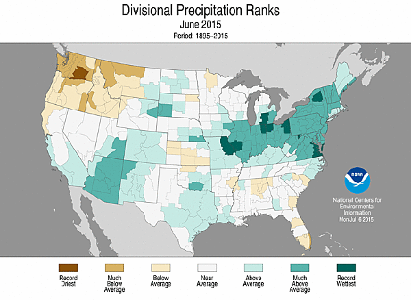
This week we first take a look at what was in the form of the June precipitation map for the U.S. Count yourself unlucky if you reside in those areas that set new wetness records; and even more unlucky if you tried to make anything resembling dry hay.
Our next National Weather Service map shows observed precipitation for the past two weeks. Unfortunately, many of those areas that got ample rain in June also are getting more than their fair share in July. Note the red-toned areas indicate 5 to 10 inches of precipitation in the past 14 days. Missouri and Kentucky are the dubious award winners for this week's most red.

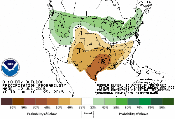
The final map this week looks to the near future (July 18 to 22). Long-term weather forecasting is not an exact science, but makes for good coffee shop talk. Northern sections of the U.S. are predicted to be above normal for precipitation, while south central regions appear headed for a dry spell.