The El Niño discussion continues, but there are still few known or tangible impacts for the U.S. In a report released by the National Oceanic and Atmospheric Administration (NOAA) on September 10, the current El Niño has been upgraded to strong status and there is an approximately 95 percent chance that El Niño will continue through the Northern Hemisphere winter 2015-16, gradually weakening through spring. At this point, all we know for sure is that there are high expectations this El Niño will eventually cause its typical weather anomalies.
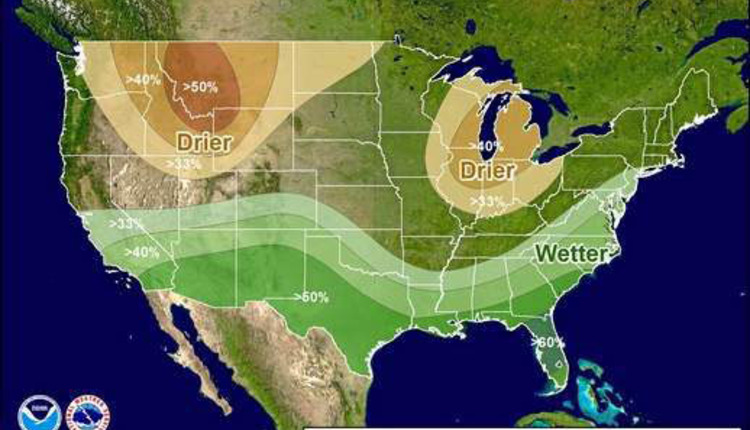
The NOAA report indicates that across the contiguous U.S., temperature and precipitation impacts associated with El Niño are expected to remain minimal during the early fall and increase into the late fall and winter. In other words, the fact that we have not seen much for tangible weather shifts to date is not surprising. If predictions are correct, November through February is when things become wetter, drier, warmer and/or cooler (see figure) depending on where you hang your hat.
The big question is if El Niño will relieve the ever-deepening California drought conditions. Forecasters are cautious in this assessment. Though the likelihood of above normal precipitation is quite high, there is no expectation that the current El Niño will provide enough moisture to bring water reserves back to predrought levels. For that to happen, nearly three times more than normal precipitation amounts would be needed.
It's expected that El Niño will contribute to below normal Atlantic Ocean hurricane activity, and to above normal hurricane seasons in both the central and eastern Pacific hurricane basins.