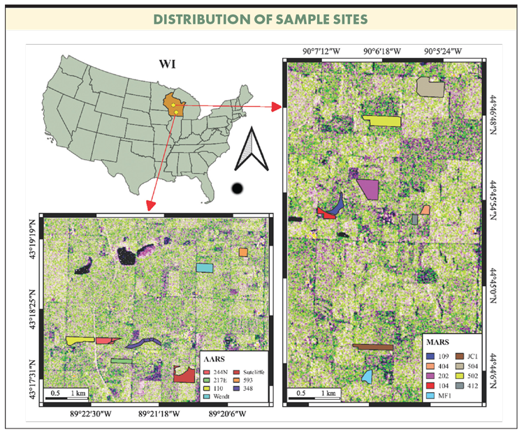
To optimize profitability in today’s era of small margins, preharvest insight into yield and quality factors can enable real-time management responses to fluctuating market conditions or feed needs. Until now, however, the acquisition of timely information at the field scale was limited to using traditional measurements such as destructive sampling and assessment of plant maturity. Although on-harvester yield mapping systems exist, the state of this technology with alfalfa results in yield maps that are generated postharvest.

Measuring the quality of dry hay production is expensive in terms of the time it takes to obtain samples and laboratory fees. Consequently, producers are not able to use this data to make timely management decisions. Therefore, there is a critical need to develop an efficient and cost-effective tool to estimate alfalfa yield and quality at the field-scale. This was the primary driver for Zhou Zhang of the University of Wisconsin-Madison to research and develop an open-source, web-based tool to predict alfalfa yield and quality.
“Timely estimation of alfalfa yield and quality within the growing season is crucial, as it can inform precision management decisions, reducing potential production loss and optimizing harvest timing to enhance forage quality and production,” said Zhang. “Remote sensing techniques offer a nondestructive, efficient way to monitor crop growth, utilizing various types of publicly available satellite imagery. Machine-learning models can develop empirical predictive algorithms using historical ground truth records to forecast future outcomes.”
The study focus was to develop interpretable machine-learning models to predict alfalfa yield and quality using publicly available remotely sensed imagery and environmental information. Additionally, they sought to create an open-source tool for end users to interactively access and visualize yield estimations.
“The biggest challenge we had was selecting the right features from the remote sensing data and environmental information that accurately estimate yield and quality,” Zhang notes. “While the Sentinel-1 satellite provides stable, high-resolution all-sky SAR images, the information alone was insufficient so, we included environmental data, which is continuous and closely related to crop growth conditions to improve prediction accuracy.”
Zhang’s take-home message is farmers should know publicly available remote sensing imagery and environmental data can be utilized to estimate yield and quality of alfalfa before harvest. “Integrating these resources into an online tool enables quick and efficient monitoring of field conditions, providing valuable insights for subsequent management decisions,” she added.
One thing that did surprise Zhang, however, was the significant impact of environmental factors. “Incorporating factors such as daylight duration, precipitation, incident shortwave radiation flux density, vapor pressure, and growing degree days greatly improved prediction accuracy.”
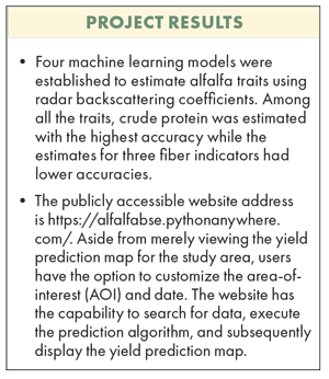
Farmers can utilize the data by reading the full report and trying the web tool to generate yield maps for their fields. The tool not only presents uploaded yield maps but also supports the generation of yield maps for customized areas defined by users, allowing farmers to set the interested field boundaries and dates.
Zhang’s future research will integrate more diverse data sources. While this study uses mainstream machine-learning methods, she plans to explore and apply more advanced, cutting-edge techniques for predictions in the near future.
A full copy of the final report can be found at https://alfalfa.org.
This article appeared in the November 2024 issue of Hay & Forage Grower on pages 16-17.
Not a subscriber?Click to get the print magazine.

