Weather prognosticators at the National Oceanic and Atmospheric Administration’s (NOAA) Climate Prediction Center expect La Niña to play a role in this winter’s weather. They look for the climate phenomenon to develop during late fall or early winter but anticipate a weak, short-lived event.
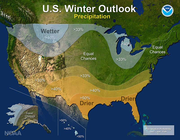
NOAA issued its U.S. 2016-2017 Winter Outlook last week and expects to see warmer, drier conditions in the South and cooler, wetter weather for much of the North. The summary looks like this:
Precipitation:
- Wetter than normal conditions are most likely in the northern Rockies, around the Great Lakes, in Hawaii, and in western Alaska.
- Drier than normal conditions are most likely across the entire southern U.S. and southern Alaska.
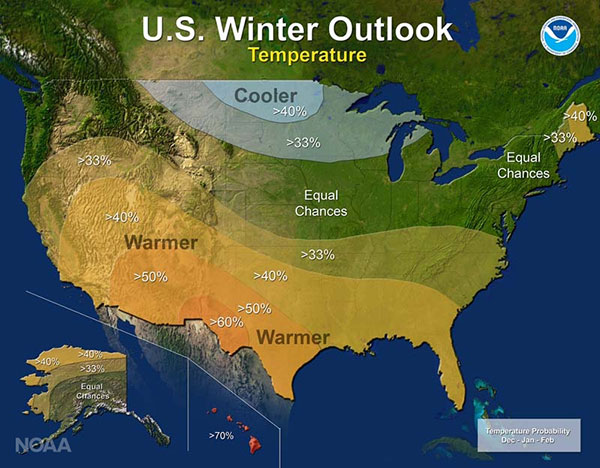
Temperature:
- Warmer than normal conditions are most likely across the southern U.S., extending northward through the central Rockies, in Hawaii, in western and northern Alaska, and in northern New England.
- Cooler conditions are most likely across the northern tier from Montana to western Michigan.
- The rest of the country falls into the “equal chance” category, meaning that there is not a strong enough climate signal in these areas to shift the odds, so they have an equal chance for above-, near-, or below-normal temperatures and/or precipitation.
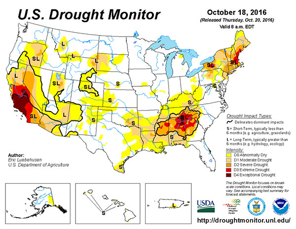
Drought:
- Drought will likely persist through the winter in many regions currently experiencing drought, including much of California and the Southwest.
- Drought is expected to persist and spread in the southeastern U.S. and develop in the southern Plains.
- New England will see a mixed bag, with improvement in the western parts and persistence to the east.
- Drought improvement is anticipated in Northern California, the northern Rockies, the northern Plains, and parts of the Ohio Valley.